Gas station nearby Green-Oil Station, TKC
Cameroon
Gas station nearby Green-Oil Station, TKC
Green-Oil Station, TKC
Yaoundé, Cameroon
contacts phone
:
+237
Latitude:
3.8373348
, Longitude:
11.4741204
larger map & directions
read more
nearest Gas station
469 m
Gulfin Station TKC
Yaounde
Gas station
read more
706 m
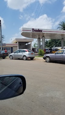
Tradex Mendong
Yaounde
Gas station
read more
856 m
Total Mendong
Unnamed Road, Yaounde
Gas station
read more
1.139 km
Oilibya
Biyem-Assi, Yaoundé
Gas station
read more
2.055 km
Green-Oil, Biyem-Assi
Biyem-Assi, Yaoundé
Gas station
read more
2.279 km
Station Service TOTAL
Yaounde
Gas station
read more
2.481 km
Oilibya Biyem Assi
Carrefour Biyem - Assi, Yaounde
Gas station
read more
2.85 km
Goshen Olympic
Yaounde
Gas station
read more
2.883 km
Station Tradex
Unnamed Road, Yaounde
Gas station
read more
2.899 km
Rond Point Damase ,Tradex
Yaounde
Gas station
read more
3.112 km
Vogt Tradex Fuel Station
Carrefour Vogt, Yaounde
Gas station
read more
3.288 km
Neptune Station of Post School
Yaounde
Gas station
read more
3.437 km
Gulfin Station Obobogo 2
Guidon 2 station, Yaounde
Gas station
read more
3.453 km
Gulfin Obobogo 1
Yaounde
Gas station
read more
4.083 km
Tradex Nsam Yaounde
tradex nsam, Yaounde
Gas station
read more
4.638 km
oil Lybia Olézoa
Avenue Charles Atangana, Yaounde
Gas station
read more
4.739 km
Mrs Nsam
N2, Yaounde
Gas station
read more
4.739 km
MRS, Olezoa
Yaounde
Gas station
read more
5.208 km
Gas station
Yaounde
Gas station
read more
5.244 km
Afriland First Bank POS - Oilibya New Messa
Messa, Yaounde
Gas station
read more
5.574 km
YAOUNDE MAGZI TOTAL
Entrée de la ville en Venant de Douala, Avant la Sociéte Patrice Bois, Yaoundé
Gas station
read more
5.574 km
Total Magzi
Yaounde
Gas station
read more
6.012 km
Oilibya Essomba
Ecole de Police Rue Sébastien Essomba, Yaoundé
Gas station
read more
6.026 km
Oilibya School Of Police
Carrefour Ecole de Police Rue Sébastien Essomba, Yaoundé
Gas station
read more
6.064 km
Station MRS
Ekoudou, Yaoundé
Gas station
read more
📑
all categories
Accounting
Administrative area level 2
Airport
Amusement park
Art gallery
Atm
Bakery
Bank
Bar
Beauty salon
Book store
Bus station
Cafe
Campground
Car dealer
Car rental
Car repair
Car wash
Casino
Cemetery
Church
City hall
Clothing store
Colloquial area
Convenience store
Courthouse
Dentist
Doctor
Electronics store
Embassy
Establishment
Finance
Fire station
Food
Funeral home
Furniture store
Gas station
General contractor
Grocery or supermarket
Gym
Hair care
Hardware store
Health
Home goods store
Hospital
Insurance agency
Jewelry store
Laundry
Lawyer
Library
Liquor store
Local government office
Locality
Lodging
Meal delivery
Meal takeaway
Mosque
Movie theater
Moving company
Museum
Natural feature
Neighborhood
Night club
Park
Parking
Pet store
Pharmacy
Place of worship
Point of interest
Police
Post office
Premise
Real estate agency
Restaurant
Roofing contractor
Route
School
Shoe store
Shopping mall
Spa
Stadium
Storage
Store
Supermarket
Taxi stand
Train station
Travel agency
University
Zoo
sublocality level 1
↑